
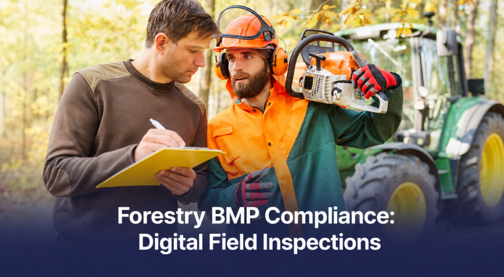
Forestry best management practices, usually shortened to BMPs, are the operational rules that protect water quality during timber harvesting: streamside buffers, stream crossing construction, road and skid trail drainage, and erosion control on disturbed ground.
BMP compliance is assessed by field inspection, so the whole system rests on somebody walking the site and writing down what they find. Whether that record is defensible afterwards depends on how it was captured.
This article explains what forestry BMPs cover and what an inspection checks, why the practice exists under different names in different countries, and what published implementation data shows about where compliance breaks down. It covers why these inspections are difficult to document on paper, how to run them digitally in seven steps, and how digital records support certification audits under FSC, PEFC and SFI.
BMP is a North American term, so the article maps the equivalent obligations in the UK, the EU and Canada as it goes.
Key takeaways
- Forestry BMPs are practices that protect water quality during forest operations, covering stream crossings, roads, skid trails, riparian buffers and erosion control.
- The same obligations exist internationally under different names, including the UK Forestry Standard water guidelines, EU Water Framework Directive river basin plans, and provincial forest practice regulations in Canada.
- BMPs are legally required in some jurisdictions and voluntary in others, but certification under FSC, PEFC or SFI makes them contractually binding regardless.
- Published US implementation rates average around 91 per cent nationally, with stream crossings and skid trails consistently the weakest categories.
- Roads, skid trails and stream crossings are the main sources of sediment reaching watercourses, ahead of the harvest area itself.
- BMP inspection records need location, date, author and photographic evidence attached at the point of capture to be useful at audit.
What Forestry BMPs Are and Why They Exist
BMPs sit in an unusual regulatory position. They are detailed enough to specify culvert sizes and buffer widths, yet in much of the United States they carry no legal force at all, and outside North America they are not even called BMPs.
Understanding what you are actually obliged to do, and by whom, is the first step in building an inspection programme that holds up.
What are forestry best management practices?
Forestry best management practices are specific, practical measures applied during a forest operation to keep sediment and pollutants out of watercourses.
Leaving an unharvested strip of trees along a stream is a BMP. So is installing a culvert sized for the flow it has to carry, laying slash on a skid trail to protect the soil surface, building water bars into a road grade so runoff leaves the surface before it gathers speed, and seeding a landing once the job is finished.
Each one is a modest engineering decision on its own. Together they decide whether a harvest leaves a watercourse in the state it was found.
The reason the water quality angle carries so much weight is the scale of the resource involved. The National Association of State Foresters estimates that more than half of drinking water in the United States originates in forested landscapes, and PEFC cites a US Forest Service figure of roughly 180 million people relying on forested land to capture and filter their drinking water. Forest operations are one of the few industrial activities that take place directly inside drinking water catchments.
Where BMP requirements come from, by jurisdiction
BMP is North American terminology. In the United States the framework traces to the Federal Water Pollution Control Act of 1972, which required states to develop forestry BMPs to address nonpoint source pollution from forest operations. That produced fifty separate state programmes, not one national standard, and their legal force varies considerably.
Outside North America the same practices exist under different labels and different legal instruments. The table below is a rough map for teams working across borders.
Jurisdiction | What it is called | Legal character |
United States | Forestry best management practices (BMPs), issued state by state | Regulatory, quasi-regulatory or voluntary depending on the state |
Canada | Provincial forest practice requirements, such as riparian management under British Columbia’s Forest and Range Practices Act | Regulatory, with independent audit |
United Kingdom | UK Forestry Standard Guidelines on Forests and Water, with an accompanying practice guide | Standard-based, tied to grant and felling licence conditions |
European Union | Water Framework Directive river basin management plans, implemented through national forestry rules | Directive-driven, transposed into member state law |
Elsewhere | National or state codes of forest practice | Varies widely |
The UK case shows how prescriptive these rules can get. The UKFS practice guide on managing forest operations to protect the water environment, updated in January 2025 to reflect the fifth edition of the standard, restricts which operations may happen inside riparian buffer areas at all, and specifies that mounding must stop within two metres of a watercourse and within five metres of a water supply abstraction point, the latter being a legal requirement in Scotland. Recommended buffer widths start at five metres for streams up to a metre wide and increase with stream size. Forest Research also notes that a riparian buffer must not be used to store equipment, fuel, oil or chemicals.
In the EU, forestry sits inside the Water Framework Directive, which requires member states to achieve good ecological and chemical status for water bodies within river basin districts. Characterisation work under the directive identified forestry as a potential diffuse pollution pressure, specifically through sedimentation from harvesting and road construction, acidification in sensitive catchments, and eutrophication from fertilisation and from harvesting on peat soils. Those three mechanisms are the same ones BMP programmes target.
Why BMPs are voluntary on paper, but mandatory in practice
A national survey of all fifty US state forestry agencies, published by Cristan and colleagues in Forest Ecology and Management, found twenty states with non-regulatory BMP guidelines, nineteen quasi-regulatory and eleven regulatory. Every state had a documented BMP manual and thirty-nine ran monitoring programmes, with the state forestry agency leading in thirty-five of them.
The voluntary label misleads, because certification closes the gap. Landowners operating under a forest certification system are required to use BMPs, and certified wood procurement organisations require the loggers supplying them to use them as well. SFI is explicit about it: the standard requires participants to run a programme implementing federal, state or provincial water quality BMPs across all phases of management activity. An operation selling into a certified supply chain is bound by BMPs whether or not its state government requires them.
What a BMP Inspection Actually Checks
BMP audit forms vary by jurisdiction, but the operational categories behind them are consistent enough that one inspection template covers most of them once the local thresholds are swapped in.
Stream crossings
Stream crossings are the highest-risk item on the list. Research on forest operations identifies stream crossings as a primary entry point for sediment from the transportation network into streams, because they connect a disturbed surface directly to flowing water.
An inspection covers crossing type and construction, approach grade and length, surfacing, water control structures above the approach, and whether the structure is sized for the channel. Crossings are also where compliance most often slips, which the implementation data below bears out.
Forest roads and skid trails
Roads and trails matter more than the harvest area itself. A review of sediment budgets in California found that roads and skid trails contributed roughly two-thirds of management-related sediment across North Coast watersheds.
Inspections check grade, drainage spacing, ditch and culvert condition, surface cover, and whether runoff is being dispersed before it reaches a channel. Treatment makes a large difference here. One Virginia study measured soil erosion from bladed skid trails dropping by around thirty times when slash or mulch was applied, compared with bare soil and water bars alone.
Streamside management zones and riparian buffers
These go by SMZs, RMZs, riparian buffers or buffer areas depending on where you are. The inspection checks that the zone was identified before harvest, that its width matches the applicable threshold for that watercourse, that retention inside the zone meets requirements, and that prohibited activities have stayed out.
The prohibited list is where jurisdictions diverge most, so the checklist has to carry local thresholds, not generic ones.
Fuel, chemicals and waste
This section covers refuelling and servicing locations, chemical storage, spill kits, and waste handling. It is less about erosion than about acute contamination, and it usually runs short, with mandatory photographs of storage areas.
Closure and post-harvest restoration
The final inspection covers whether temporary crossings were removed, drainage structures left functional, disturbed areas stabilised and seeded, and roads put to bed properly.
Closure is frequently the point where a compliant harvest becomes a non-compliant one, because the crew has moved to the next site and nobody has been back to look.
What the Implementation Data Shows
Forestry compliance is unusually well measured, at least in the United States, where state agencies have been running randomised implementation surveys for decades. The numbers are worth knowing because they show where inspection effort pays.
The national picture is strong in aggregate. The fifty-state survey reported a mean national BMP implementation rate of 91 per cent across the thirty-two states that had conducted implementation studies, while noting deficiencies within specific guideline categories that the headline figure conceals.
The category breakdown carries the useful detail. Work by Cristan and colleagues across the southeastern United States, reported in a later erosion study, found the following mean implementation rates.
Category | Mean implementation rate |
Decks and landings | 95.8% |
Timber harvest areas | 95.0% |
Overall state average | 92.4% |
Forest roads | 91.3% |
Skid trails | 89.7% |
Stream crossings | 89.2% |
The pattern is consistent, and it runs backwards from what you would expect. Compliance is highest where the timber is and lowest at the crossings and trails, which is exactly where the sediment risk concentrates. Regional averages have been reported at around 93.6 per cent across the southeast, with the same weak categories underneath.
State-level surveys add texture. Georgia’s 2021 implementation survey recorded an overall score of 92.58 per cent, down from 94.40 per cent in 2019, with continuing issues at stream crossings and SMZs. The more interesting finding is distributional: water quality risks rose from thirty-four to fifty-eight between surveys, and were concentrated on a small number of sites, as had been the pattern for most of the preceding fifteen years. The survey linked the problem to smaller tracts, parcelisation and ownership change. Texas reports a current implementation rate of 91.5 per cent across twelve surveys since 1990.
Three things follow for anyone designing an inspection programme.
- Aggregate compliance scores hide the categories that matter, so inspections should weight crossings and trails more heavily than harvest areas.
- Failures cluster on a minority of sites instead of spreading evenly, which makes identifying those sites early the highest-value thing an inspection programme does.
- Parcelisation makes both harder, because more owners and smaller tracts mean more operators, more handovers and more places for a record to go missing.
Comparable published implementation data is scarce outside the United States. Auditing exists elsewhere, but it gets reported differently.
British Columbia’s Forest Practices Board publishes audit and investigation findings instead of percentage implementation rates, and its 2022 review of fifteen years of forestry and water reports found that licensees generally complied with legal requirements while identifying gaps in how cumulative watershed effects are managed.
Research in Sweden has examined how riparian buffer protection responded to the Water Framework Directive and to certification, including the finding that small streams were less likely to receive buffers than large ones, partly because they are underrepresented on maps.
That is a data capture problem before it is a compliance problem, and a field inspection is what catches it.
Why BMP Inspections Are Hard to Document on Paper
The inspection itself is not complicated. The hard part is producing a record of it that still holds up when an auditor asks about it two years later.
A crossing is not identifiable without coordinates
A harvest might have four stream crossings, three of them similar in construction. A paper form recording that a crossing was inspected and found compliant does not establish which crossing, and a photograph without location metadata does not either.
When a downstream sediment complaint names a specific point on a specific watercourse, the operation needs to show what was recorded at that point on that date.
Thresholds vary and crews often memorise the wrong ones
Buffer widths change with stream class, slope, jurisdiction and sometimes certification scheme. A contractor working across a state line, or across a client boundary with different certification commitments, is applying different numbers on different sites in the same week.
Paper checklists rarely encode the thresholds, so they rely on the inspector remembering which rule set applies.
The evidence is photographic and paper cannot hold it
Most BMP findings are visual: cover on a trail, water flowing clear or turbid below a crossing, a functioning water bar.
Photographs taken on a phone and paper forms filled in by hand are two separate artefacts that have to be reunited later by someone matching timestamps to entries, and they get separated often enough that nobody treats it as unusual.
Closure inspections happen after everyone has left
The final BMP check is the one nobody is on site for. It gets scheduled, deferred, and sometimes filled in from memory. That is the inspection most likely to matter, because post-harvest condition is what a regulator or a certification auditor sees when they visit months later.
Multiple parties, one record
A harvest can involve a landowner, a management organisation, a consulting forester, a logging contractor and a haulier, with a certification auditor arriving afterwards. Paper moves between them slowly and gets amended without attribution.
This is the structural problem described in our guide to field inspection apps for forestry and timber operations, and BMP records are where it bites hardest, because the party who did the work and the party who answers for it are frequently not the same company.
How to Run BMP Inspections Digitally
The goal is a record that an auditor, a regulator or a client can be handed without preparation. These seven steps get most operations there.
Step 1: Build the form from the audit questionnaire you are actually assessed against
State agencies and certification bodies publish the categories they assess. Start from that document, not a generic inspection template, so the record you produce maps directly onto the assessment you will face. In the US that means the state audit categories; in the UK it means the relevant UKFS water guidance; elsewhere it means the applicable code of practice.
Step 2: Encode the thresholds instead of relying on memory
Buffer widths, approach length limits and drainage spacing should be built into the form as conditional fields, so selecting a stream class produces the correct minimum without requiring the inspector to know it. On operations that cross jurisdictions, this one change removes more errors than anything else on the list.
Step 3: Capture location at every crossing and structure
Each crossing, culvert, water bar and buffer measurement should carry its own coordinates, recorded at submission rather than typed. Without coordinates, a BMP record says something general about a site. With them, it says something specific about a point on that site.
Step 4: Make photographs mandatory where the finding is visual
Required photo fields attached to the specific question keep the evidence and the finding in one record. Before and after images at crossings and closed trails are worth the extra minute, particularly on sites with any history of complaint.
Step 5: Work offline by default
Harvest sites routinely sit outside mobile coverage, and an inspection tool that needs a connection at the landing will be abandoned within a season. Forms should complete and queue with no signal, then sync on return to coverage.
Step 6: Schedule the closure inspection as a separate record
Treat post-harvest closure as its own form with its own trigger rather than a section at the bottom of the operational check. It happens at a different time, often with a different person, and it should show as outstanding until someone completes it.
Step 7: Track findings to resolution
A BMP inspection that identifies a problem is only useful if the fix is recorded too. Corrective actions should link back to the original finding with their own photographs and date, so the pair reads as a closed loop and not an open exception.
How BMP Records Support Certification and Traceability Claims
Certification auditors assess documented systems. FSC does not carry out its own audits; independent accredited certification bodies do that work, which means the auditor arrives without prior knowledge of the operation and forms a view from the record. PEFC requires that forests be managed so they continue to purify water, with particular care in areas relevant to freshwater provision. SFI requires a programme implementing applicable water quality BMPs. In each case, what the auditor works from is field records.
The same data has a second use. BMP records are increasingly part of the sustainability claim attached to the material itself, not only to the management unit. Buyers asking for evidence of responsible sourcing are asking about conditions on the ground during harvest, and BMP inspections are the closest thing most operations have to a systematic record of those conditions.
Verifiable records matter for exactly this reason. A digital record improves on paper by being legible, dated, located and attributable. Anchoring a cryptographic fingerprint of it to a public blockchain goes further, letting anyone confirm the record existed at a given moment and has not been altered since, without publishing the underlying data. It is worth being precise about what that proves. Anchoring establishes integrity, not accuracy. It shows a record has not changed, and says nothing about whether the inspector assessed the crossing correctly. Our guide to blockchain traceability explains the mechanics.
For a picture of where this leads at industry scale, our case study on ForesTrust and the U.S. wood supply chain looks at a consortium built to carry verified records between forest products companies. The lesson that transfers is that the ledger only preserves what the first mile hands it. A BMP inspection is part of that first mile.
How to Run BMP Inspections Digitally
VerusTrust Forms is a field data collection platform with optional blockchain verification. Teams build their own inspection forms, run them offline in the field, and hold the results in one place with permissions matching who is accountable for what.
Drag-and-drop form builder
Rebuild your existing BMP audit sheet as a structured form without developer time, and revise it when the state guidance or the standard behind it changes.
AI Form Builder
Generates a first-draft form from a plain-language description of the inspection, which shortens the setup work when several BMP checklists need converting at once.
Advanced field types
Stream class dropdowns, numeric buffer width fields with limits, mandatory photographs at crossings, signatures, and conditional sections that show the right thresholds for the watercourse selected. This is what Step 2 above requires in practice.
GPS data collection
Every submission can easily be made to carry coordinates captured at the point of record, so each crossing, culvert and buffer measurement is tied to a location instead of a site name.
Mobile app with offline mode
Crews complete full inspections with no connectivity and submissions sync when the device returns to coverage, with anchoring running on sync.
User roles and permissions
Contractors submit, foresters review, compliance approves, clients and auditors read. Where a landowner, a manager and a logging contractor all touch the same BMP record, this is what keeps attribution intact.
Blockchain verification
For the records most likely to be challenged, a cryptographic hash of each submission is anchored to a public blockchain such as Ethereum while the data stays encrypted on your account. Blockchain verification is included on every paid plan.
Submission dashboard and exports
See which sites are inspected, which closure checks are outstanding, and which findings remain unresolved. Records export to standard spreadsheet formats for agency reporting, certification files and client deliverables.
Microsoft Azure hosting and security
The encrypted records run on Microsoft Azure with enterprise-grade security and data residency options.
Start Documenting BMP Compliance You Can Defend
The implementation data says something specific about where inspection effort belongs. Compliance is weakest at stream crossings and skid trails, failures cluster on a small number of sites, and parcelisation is making both patterns harder to manage. Finding those sites early is what a BMP inspection programme is for, and that depends on records precise enough to compare across sites and seasons.
Build your first BMP inspection form on the free plan and run it on a live harvest, or talk to our team about mapping it against your state programme, your certification commitments, or the water guidance you work under.
Frequently Asked Questions
What are forestry best management practices?
Forestry best management practices are operational measures that protect water quality during forest operations, including streamside buffers, stream crossing construction, road and skid trail drainage, erosion control on disturbed ground, and post-harvest stabilisation. In the United States they are issued state by state.
Are forestry BMPs legally required?
It depends on the jurisdiction. Across US states, published survey work found roughly a fifth with regulatory guidelines, a further group quasi-regulatory, and around twenty non-regulatory. Certification under FSC, PEFC or SFI makes BMP implementation binding regardless of the local legal status.
What does a BMP inspection check?
A BMP inspection assesses stream crossings, forest roads, skid trails, streamside management zones, decks and landings, fuel and chemical handling, and post-harvest closure. Each category is scored against the thresholds that apply in that jurisdiction.
Which are the BMP categories that fail most often?
Stream crossings and skid trails. Southeastern US survey data records implementation of around 89 per cent for both, against roughly 95 per cent for harvest areas and landings. Crossings and trails are also where most sediment reaches watercourses.
Do BMPs exist outside the United States?
Yes, under different names. The UK applies UK Forestry Standard water guidelines, EU member states work within Water Framework Directive river basin plans, and Canadian provinces regulate riparian and road practices through forest practice legislation. The operational content is broadly similar.
How do digital records help with a BMP audit?
Digital inspection records carry coordinates, timestamps, author and photographs on each submission, so a specific crossing or buffer can be located and its condition on a given date evidenced. That is what an auditor or a regulator responding to a complaint needs to see.