
Blockchain-Verified Wildlife Data: Lessons from the WWF Bison Rewilding Project for Conservation Field Teams
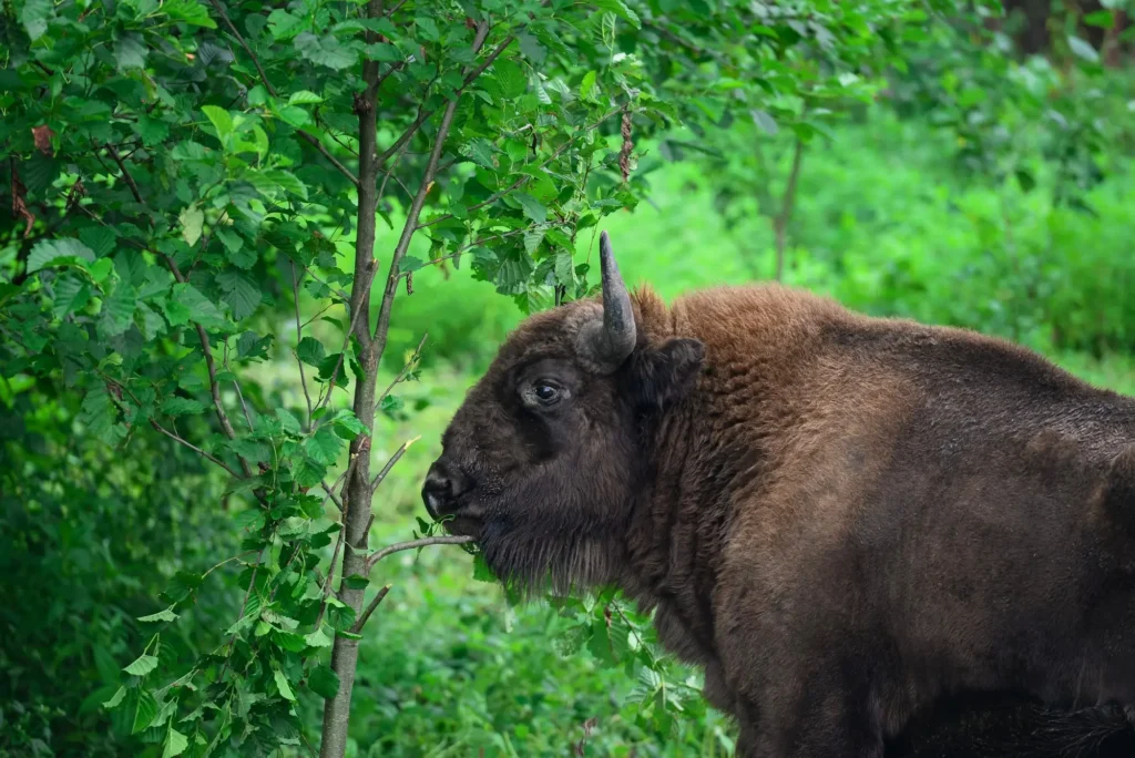
The Case Study At a Glance
WWF, via its Bison Rewilding Project
near Armenis, in Romania’s Southern Carpathian Mountains, a 300-acre fenced rewilding enclosure
Aalborg University’s Department of Civil Engineering, Wuhan University of Technology’s School of Management, and the National University of Kyiv-Mohyla Academy
Proceedings of the 2nd International Conference on Big Data Technologies (ICBDT 2019), August 2019
that a blockchain-backed framework could protect sensitive GPS wildlife-tracking data from misuse while still making it useful and accountable to rangers, researchers, donors, and tourists
Blockchain-verified wildlife data is a real, evidence-backed approach, not just another vendor buzzword. The way to tell the difference is to look for independent, peer-reviewed research instead of product marketing.
That research exists. In 2019, researchers at Aalborg University and Wuhan University of Technology published a blockchain-based data-management framework for WWF’s Bison Rewilding Project, presented at the ACM’s 2nd International Conference on Big Data Technologies.
This piece walks through what they built, what it actually proved, where its evidence stops, and what a conservation program without a university research partner can take from it today.
The Challenge
Wildlife tracking data is a double-edged resource. The same GPS coordinates that let rangers protect a herd and let researchers study its movement are exactly what a poacher needs to find it. The risk isn’t hypothetical: the paper cites a documented 2013 case in India where cyber-poachers attempted to access GPS collar data on tracked tigers specifically to locate the animals.
A rewilding program like WWF’s Bison Rewilding Project depends on sharing location data with rangers, researchers, local authorities, and even donors and tourists, while keeping exact animal locations away from anyone who could exploit them.
Those two goals pull in opposite directions. Open, shared data helps a program build support and demonstrate results. Restricted, siloed data protects the animals it’s meant to help. The Aalborg and Wuhan University researchers built their framework specifically to resolve that tension for the bison project.
The Approach
The framework builds on MIT’s Open Algorithms (OPAL) model, a design principle where raw data never leaves the system that collected it. Instead of centralizing GPS coordinates in one place, a data-holding node runs the query itself and returns only a processed result, a species count, a general area, or a donation-eligible profile, never the animal’s exact location.
Blockchain sits on top of that model as the accountability layer. It isn’t where the data itself is stored. Every request from a stakeholder, and the aggregated response sent back, gets logged to a private blockchain, along with any automated alert sent to a verified user when a bison approaches a restricted zone.
The system splits users into two tiers: verified users, farmers, rangers, researchers, and local authorities, get real-time proximity alerts, while general users, tourists and virtual adopters, get aggregated species information and a donation pathway. Neither tier is ever handed the raw GPS feed directly.
That structure lets a wide range of stakeholders, ten distinct groups by the researchers’ own count, interact with the same underlying dataset at different levels of access, with the blockchain providing a record of who requested what and when instead of leaving that history undocumented.
The Results: What the Project Proved (and Its Limits)
The researchers’ own paper is direct about scope. This is a proposed framework, and the authors are clear it was never built and deployed in the field. They state plainly that they hadn’t measured real-world use of the animal-adoption application, and that user acceptance of the blockchain-based technology remained unexplored.
What the paper does establish, however, is that the architecture holds up on its own terms. An OPAL-based data model can keep sensitive wildlife-tracking data out of centralized, exploitable storage while still routing useful, aggregated information to the stakeholders who need it, and a private blockchain can log every one of those exchanges without exposing the underlying data itself.
The researchers argue this combination would reduce costs, support donor engagement, and give local authorities an evidence base for wildlife-protection policy. Those claims follow logically from the design, but the paper itself doesn’t back them with field deployment numbers.
That’s a meaningful distinction. A framework that’s architecturally sound and peer-reviewed is real evidence that blockchain-verified wildlife data isn’t hypothetical. A framework with published adoption or poaching-reduction statistics would be evidence of something further, though, and this paper doesn’t claim to be that.
The Wider Pattern
The bison framework wasn’t the only sign that conservation technology was maturing past isolated tools. In 2025, eight major conservation organizations, including WWF, WCS, Panthera, and Re:wild, agreed to merge two of the sector’s most widely used platforms, SMART and EarthRanger, into a single system called SERCA, with rollout beginning before the end of that year.
SMART and EarthRanger solved different problems for years. SMART handled patrol data and analysis across more than 1,200 sites in over 100 countries, while EarthRanger brought real-time mapping and mobile reporting to more than 900 sites in 80-plus countries. Programs that needed both ended up managing two separate dashboards, a friction point real enough that a 2023 bridge tool, Gundi, wasn’t sufficient to resolve it on its own.
To be clear, SERCA isn’t a blockchain project. What it shows is that the sector is actively consolidating and investing in better field-data infrastructure generally, six years after the bison framework proposed a verifiable data layer for exactly this kind of infrastructure. That’s the environment a genuinely tamper-evident record has room to matter in, one where conservation programs are already rethinking how their data gets collected, shared, and trusted.
Key Takeaways
- Keep raw sensitive data local, share only results: the bison framework’s core security pattern, never centralizing exact GPS coordinates, mirrors the way VerusTrust Forms keeps a submission’s raw data off the public chain and anchors only a hash of it.
- The log matters more than the ledger: blockchain’s contribution here isn’t the technology as a talking point. It’s the checkable record of who requested or touched a piece of data, and when.
- This isn’t a new idea: the bison framework was published in 2019, years before the sector’s current infrastructure push. Blockchain-verified conservation data has been on researchers’ radar for a while.
- Architecturally sound isn’t the same as field-proven: a peer-reviewed framework is real evidence the idea works on paper. Deployment numbers, adoption rates, or measured poaching reduction would be a separate, stronger kind of evidence, and this paper doesn’t claim to have them.
- A related but different problem: the bison framework solves data security and access control. Proving a record wasn’t altered after capture is a separate, specific gap, the subject of our piece on the trust gap in conservation field data. Both point toward the same underlying shift: replacing trust in an operator with a system anyone can check.
Where VerusTrust Forms Fits for Blockchain-Verified Wildlife Conservation Data
The Aalborg and Wuhan University framework proves the underlying idea works: a wildlife program can make its data both secure and accountable, without exposing raw locations, by putting blockchain in the accountability layer instead of the data-storage layer. Building that from scratch took two universities and an academic paper. VerusTrust Forms gives a program the same principle, tamper-evident records instead of an unverifiable spreadsheet, without a research grant or a custom-built system.

Optional hash-anchoring on the fields you choose, the same tamper-evident principle the bison framework’s researchers built from scratch, available on every VerusTrust Forms plan, including the free-forever one.
Geotags species, habitat, and patrol records at the point of capture.
Full offline capture for remote rewilding and conservation sites, with sync on reconnect.
The practical equivalent of the paper’s data-management layer, a real-time, exportable, audit-ready record for funders and regulators.
Get the Same Tamper-Evident Model Without the Research Budget
Getting the same tamper-evident model the Aalborg and Wuhan University researchers proposed for the WWF Bison Rewilding Project doesn’t require a university partnership, a grant, or a custom-built system. It requires turning on a setting inside a form.
VerusTrust Forms takes the same core idea, raw data stays where it’s captured, and a blockchain-backed layer makes the record checkable to whoever needs to check it, and makes it available out of the box.
For the fuller picture, see how VerusTrust Forms compares to other field data tools for conservation programs in our roundup of the best field data collection apps for conservation and wildlife organizations, or walk through the exact fields and settings in our step-by-step guide to capturing geotagged, blockchain-verified records.
Start for free, no credit card required, and anchor a real species count or patrol log to see the same underlying principle at work today, no research team required.