
How to Capture GPS Points, Lines and Polygons in VerusTrust Forms
VerusTrust Forms captures location with three map fields: Map Point for a single location, Map Line for a route, and Map Area for a boundary, also called a polygon. Add the field you need to your form in the builder.
Then, when someone fills in the form, they place the location directly on the embedded map: one click for a point, a click at each turn for a line, and a click at each corner for an area.
This guide is part of the VerusTrust Forms Help Center. It shows how to pick the right field, capture each type, and check the result before you submit, on the web or in the mobile app with no signal.
Which Map Field Do You Need?
First, you need to decide which map field fits your needs.
| Field | What it captures | Use it for |
|---|---|---|
|
Map Point
|
One location, shown as a single pin
|
Where an incident happened, an asset, a sample site, a sighting
|
|
Map Line
|
A path made of connected points
|
A route walked or driven, a fence line, a pipe or cable run, a patrol
|
|
Map Area
|
A closed shape made of connected points
|
A site boundary, a field or harvest block, an inspection zone
|
If you’re unsure, ask what someone will need to know later. “Where?” calls for a point. “Which way?” calls for a line. “How much ground?” calls for an area.
Step 1: Add a Map Field to Your Form
Open your form in the builder and drag Map Point, Map Line or Map Area from the Elements panel onto the canvas. Select the field to name it in the Field Configuration panel, for example “Incident Location” or “Work Route”, and tick Required if the form shouldn’t be submitted without a location.
New to the builder? Start with how to build your first form, and see how to add advanced field types for the field settings.
Step 2: Capture a Point
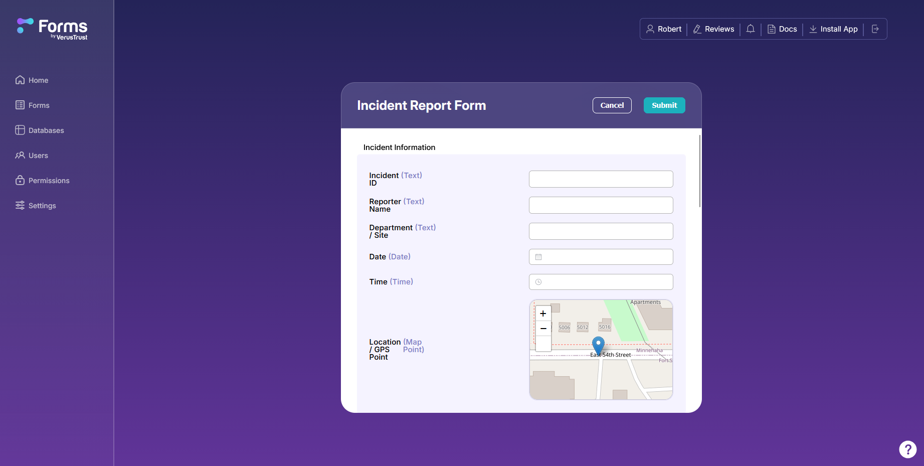
When someone fills in the form, a Map Point field shows an embedded map. Use the + and − buttons to zoom in on the right spot, then click the map where the location is. A pin marks the point.
Check the accuracy information the map shows for the point before you submit. It tells you how precisely the location was captured, which matters most when the record might be questioned later.
Step 3: Capture a Line
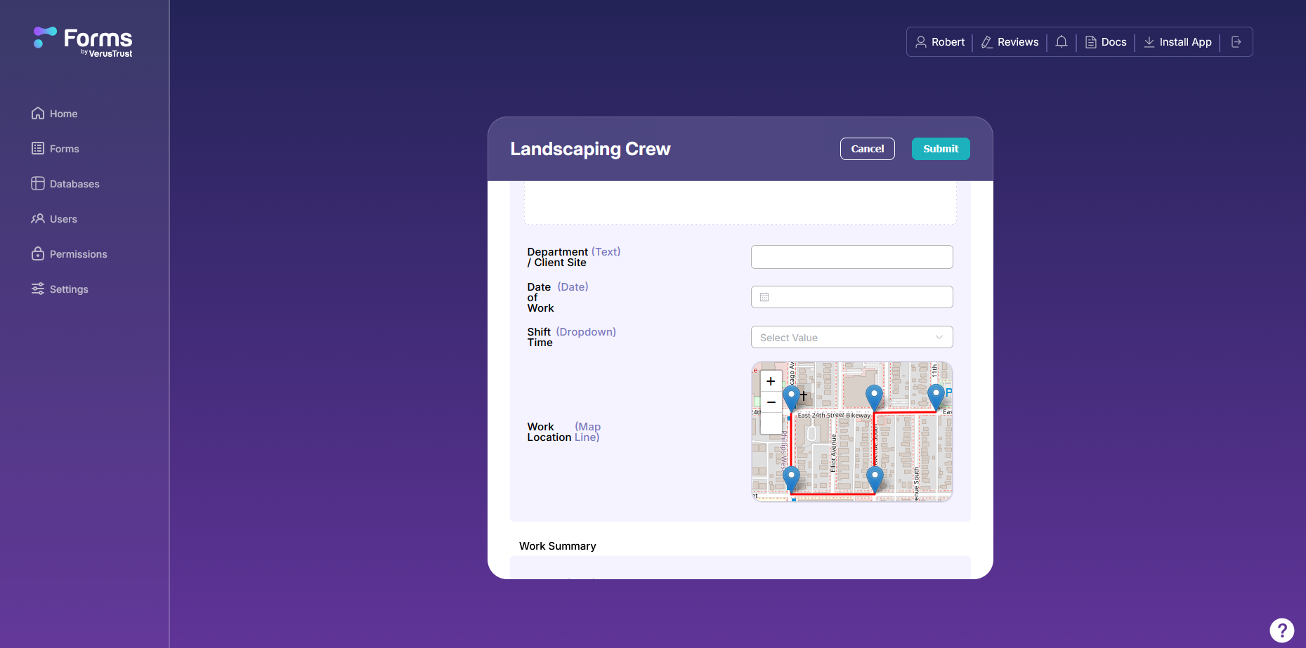
A Map Line field works the same way, one click at a time. Click the start of the path, then click at each point along it, in order. VerusTrust Forms joins the points into a line as you go.
Add a point wherever the path changes direction. A route that follows a street grid needs a point at every corner, as in the landscaping crew example below. A gently curving trail needs points close enough together to follow the curve.
Step 4: Capture a Polygon
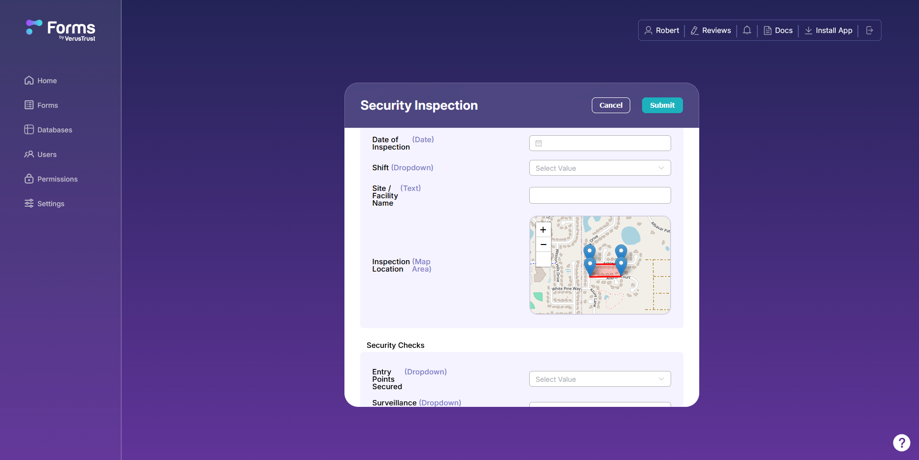
A Map Area field captures a closed shape. Click each corner of the area in turn, working in one direction around the edge. VerusTrust Forms connects the points and closes the shape, shading the area inside it.
Geometry validation checks that the points form a valid shape. A mistake such as an area that crosses over itself gets caught while you’re still on site and can fix it.
Capturing Location in the Mobile App
All three map fields work in the VerusTrust Forms mobile app, including with no signal. On a phone, a Map Point field can use the device’s GPS with Use Current Location, so a crew member standing at the spot captures it in one tap.
The location saves with the rest of the entry and syncs when the device is back online. See how to install the mobile app and collect data offline.
Tips for Accurate Location Data
- Zoom in before you click. The closer the map, the closer your pin lands to where you mean it to.
- Check the accuracy before you submit. If it looks off, adjust the location while you’re still on site.
- Give the phone’s GPS a clear view of the sky. Dense tree canopy, tall buildings and being indoors all make a GPS fix less accurate. Step into the open and wait a few seconds if the reading looks wrong.
- Put a point at every change of direction on lines and areas. Too few points cut corners off the real shape.
Every Map Change Is Logged
VerusTrust Forms keeps an activity log of every map change, including each point placed or moved and each shape edited. If a location is ever questioned, you can show how it was captured.
Turn on blockchain verification for the location field, and you can also prove the submitted location hasn’t changed since.
What to Do Next
- Turn on blockchain verification for the location fields that need to hold up in an audit or a dispute.
- Sync submissions from the field once your crew is back in range.
- Export your data to use your locations in a report.
Frequently Asked Questions
What's the difference between a Map Line and a Map Area?
A Map Line is an open path: it records the way something runs, such as a route or a fence. A Map Area is a closed shape: it records the ground inside a boundary, such as a site or a field. Use a line when the path matters and an area when the space inside matters.
Can I capture GPS locations without an internet connection?
Yes. All three map fields work in the mobile app with no signal. The location saves with the entry on the device and syncs when you’re back online.
Can I type in coordinates instead of clicking the map?
Yes. Map fields also accept coordinates entered by hand, which helps when you already have a surveyed location.
Why does my location look slightly off?
Phone GPS loses accuracy under tree canopy, between tall buildings and indoors. Check the accuracy information before you submit, and if it’s poor, move into the open, wait a few seconds, and capture the location again.
Are map fields included on the Free plan?
Yes. Map Point, Map Line and Map Area are available on every plan, including Free, along with offline capture in the mobile app.
If you haven’t signed up yet, start on the Free plan and add a map field to your first form.